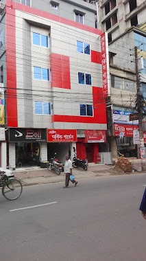
Lodging nearby Holy Inn Hotel
Bangladesh
Lodging nearby Holy Inn Hotel
Holy Inn Hotel
Chandantula, Sylhet, Bangladesh
contacts phone
:
+880 1935-666999
Latitude:
24.9012496
, Longitude:
91.8694285
larger map & directions
read more
nearest Lodging
20 m
Holy INN (Hotel)
Hazrat Shahjalal Road, Sylhet
Lodging
read more
65 m
Noorjahan Grand
Waves 1, Ritz Tower, Dargah Gate,, Sylhet
Lodging
read more
99 m
Hotel Star Pacific
982, East Dargah Gate, Sylhet
Lodging
read more
111 m
Hotel Orchid Garden
Dorgah Gate, East Hazrat Shahjalal Road, Sylhet
Lodging
read more
125 m
Hotel Dargah View
Dargah Gate, Sylhet
Lodging
read more
134 m
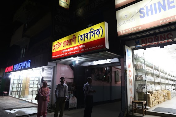
Hotel Raj-Rani (Abashik)
Sylhet
Lodging
read more
162 m
জালালাবাদ বোর্ডিং এন্ড রেষ্টুরেন্ট
Sylhet
Lodging
read more
183 m
Hotel Al Riyad
Dargah Gate, Sylhet
Lodging
read more
196 m
Hotel Ajmer
Rajar Golli, Sylhet
Lodging
read more
203 m
Hotel Bahrain
Rajar Golli, Sylhet
Lodging
read more
215 m
Hotel Ziarot
Rajar Golli, Sylhet
Lodging
read more
332 m
Hotel Himmel
Ambarkhana Road, Sylhet
Lodging
read more
367 m
Hotel City Link
Ambarkhana Road, Sylhet
Lodging
read more
369 m
Borkotia Mess
Sylhet
Lodging
read more
427 m
Hotel Shahjahan & Restaurant
Main Road Hazrat Shahjalal Road, Sylhet
Lodging
read more
495 m
Abu Sina Hostel
Medical College Road, Sylhet
Lodging
read more
686 m
Hotel Golden City
Jail Road, East Zindabazaar, Sylhet
Lodging
read more
706 m
Hotel City Heart Residential
bondor bazar, Sylhet
Lodging
read more
708 m
Hotel Rajmoni
Kakoli Chand Complex, Zindabazar Point, Sylhet
Lodging
read more
809 m
Sylhet Plaza Hotel
Point, Dhaka - Sylhet Highway, Sylhet
Lodging
read more
967 m
Hotel Baghdad
Bandar Bazar, Sylhet
Lodging
read more
975 m
হোটেল মোহাম্মাদীয়া
Sylhet
Lodging
read more
1.003 km
Hotel Al Foyes
Sylhet
Lodging
read more
1.017 km
হোটেল এমদাদিয়া
Sylhet
Lodging
read more
1.193 km
Hotel Syl View
Naiorpool Road, Sylhet
Lodging
read more
📑
all categories
Accounting
Administrative area level 1
Administrative area level 2
Airport
Amusement park
Aquarium
Art gallery
Atm
Bakery
Bank
Bar
Beauty salon
Bicycle store
Book store
Bowling alley
Bus station
Cafe
Campground
Car dealer
Car rental
Car repair
Car wash
Casino
Cemetery
Church
City hall
Clothing store
Colloquial area
Convenience store
Country
Courthouse
Dentist
Department store
Doctor
Electrician
Electronics store
Embassy
Establishment
Finance
Fire station
Florist
Food
Funeral home
Furniture store
Gas station
General contractor
Grocery or supermarket
Gym
Hair care
Hardware store
Health
Hindu Temple
Home goods store
Hospital
Insurance agency
Jewelry store
Laundry
Lawyer
Library
Liquor store
Local government office
Locality
Locksmith
Lodging
Meal delivery
Meal takeaway
Mosque
Movie rental
Movie theater
Moving company
Museum
Natural feature
Neighborhood
Night club
Painter
Park
Parking
Pet store
Pharmacy
Physiotherapist
Plumber
Point of interest
Police
Post office
Premise
Real estate agency
Restaurant
Route
Rv park, camping
School
Shoe store
Shopping mall
Spa
Stadium
Storage
Store
Subpremise
Supermarket
Taxi stand
Train station
Transit station
Travel agency
University
Veterinary care
Zoo
administrative area level 3
sublocality level 1
↑