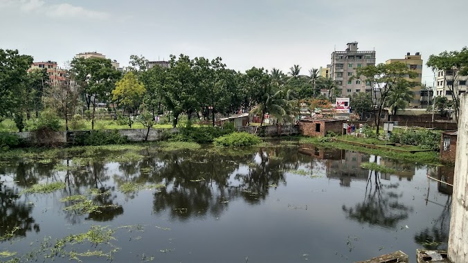
Cemetery nearby Kaliakair Koborsthan
Coronavirus disease (COVID-19) Situation
confirmed cases
2049377
deaths
29493
Bangladesh
Cemetery nearby Kaliakair Koborsthan
Kaliakair Koborsthan
Dhaka - Tangail Highway, Kaliakair, Gazipur District, BD Bangladesh
contacts phone
:
+88
Latitude:
24.0591221
, Longitude:
90.2252948
larger map & directions
read more
nearest Cemetery
22.025 km
Koborstan
Bangladesch
Cemetery
read more
26.327 km
S S CORPORATION
House 53, Road 14, Sector 13, Uttara., Uttara
Cemetery
read more
26.884 km
Cemetery Graveyard
Sector 9, Dhaka
Cemetery
read more
26.884 km
Graveyard
Sector 9, Dhaka
Cemetery
read more
27.169 km
Sector 14 Cemetery
Uttara
Cemetery
read more
28.289 km
ফায়দাবাদ গন কবরস্থান
North Chalaban, Dhaka
Cemetery
read more
28.472 km
৪ নং সেক্টর গোরস্থান
Road No 2, Dhaka
Cemetery
read more
28.476 km
Uttara Graveyeard
Dhaka
Cemetery
read more
28.481 km
Sector 4 Graveyard
Road No 2, Dhaka
Cemetery
read more
28.489 km
Kabarsthan
Dhaka
Cemetery
read more
29.254 km
Family Cemetery
Unnamed Road, Dhaka
Cemetery
read more
31.233 km
Dakhinkhan Gono Koborsthan
Dhaka
Cemetery
read more
31.265 km
Modhubaag Koborsthan
Dhaka
Cemetery
read more
31.27 km
Place nirjharera restim
Dhaka
Cemetery
read more
32.051 km
১৩নং সেকশন শিশু কবরস্থান
Mirpur
Cemetery
read more
37.017 km
Purbanchal Graveyard
Bawaila Para, Dhaka
Cemetery
read more
40.502 km
Khilgaon Tilpapara Jame Mashjid Cemetery
Dhaka
Cemetery
read more
41.257 km
Stone Centre
55 Topkhana Road, Dhaka
Cemetery
read more
41.393 km
Family Cemetery
Basabo Bazar Road, Dhaka
Cemetery
read more
42.031 km
মুগদাপাড়া কবরস্থান
Mugdapara
Cemetery
read more
49.599 km
Mahmudpur Koborsthan
Shiddhirganj
Cemetery
read more
49.818 km
Mizmizi Paschim Para Koborsthan
Shiddhirganj
Cemetery
read more
52.234 km
Adamjee Nagar Koborsthan
Kadamtoli
Cemetery
read more
57.082 km
শশ্মান কালী মন্দির
Langalband, Bandar
Cemetery
read more
57.437 km
মুছাপুর কবরস্থান
Bandar
Cemetery
read more
📑
all categories
Accounting
Administrative area level 1
Administrative area level 2
Airport
Amusement park
Aquarium
Art gallery
Atm
Bakery
Bank
Bar
Beauty salon
Bicycle store
Book store
Bowling alley
Bus station
Cafe
Campground
Car dealer
Car rental
Car repair
Car wash
Casino
Cemetery
Church
City hall
Clothing store
Colloquial area
Convenience store
Country
Courthouse
Dentist
Department store
Doctor
Electrician
Electronics store
Embassy
Establishment
Finance
Fire station
Florist
Food
Funeral home
Furniture store
Gas station
General contractor
Grocery or supermarket
Gym
Hair care
Hardware store
Health
Hindu Temple
Home goods store
Hospital
Insurance agency
Jewelry store
Laundry
Lawyer
Library
Liquor store
Local government office
Locality
Locksmith
Lodging
Meal delivery
Meal takeaway
Mosque
Movie rental
Movie theater
Moving company
Museum
Natural feature
Neighborhood
Night club
Painter
Park
Parking
Pet store
Pharmacy
Physiotherapist
Plumber
Point of interest
Police
Post office
Premise
Real estate agency
Restaurant
Route
Rv park, camping
School
Shoe store
Shopping mall
Spa
Stadium
Storage
Store
Subpremise
Supermarket
Taxi stand
Train station
Transit station
Travel agency
University
Veterinary care
Zoo
administrative area level 3
sublocality level 1
↑